
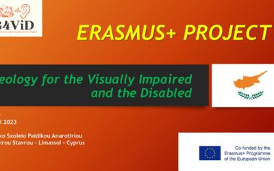
About the G4ViD project

G4ViD is a project that aims to provide students and educators, with special emphasis on the disabled and the visually impaired, the opportunity to enjoy the experience of Geoparks and introduce them to the Earth Sciences. The project also aims to provide the educational tools (maps and interactive audio-visual content) that will be developed for a remote understanding of the Geoparks for schools, teachers, and students as well as easier navigation for people with disabilities in real visits.
Our main task in this project is to develop two applications and one interactive website related to Geology and Geoparks for the visually impaired and the disabled, as well as the general public.
The first application will transform images and geological evidence such as fossils, rocks or petrified trees into sound. When this happens a visually impaired person can touch a touchscreen and “feel” according to the sound changes the shape of the fossil or geological evidence.
The second application refers to a mapping and navigation application with special features for the disabled and the visually impaired. With this mapping application, a visitor in a Geopark can be assisted in their path, especially one with a disability. This route can then be available to other visitors either they visit the Geopark, or through the interactive website.
We aim to provide extra abilities to this application such as uploading images, photos, videos and information related to points of interest in the Geopark. This will be extra useful for a real or a virtual visitor but also will be very educative for teachers that wish to provide their students with a multimedia lesson to a geological monument. Apart from this, a person with disabilities that cannot access a Geopark can thus accomplish a sort of virtual visit.
You can download our brief information leaflet on the G4ViD project here!
G4Vid products
The basis of the main intellectual outputs will be the construction of a database that will contain all necessary data and content that will be used for the implementation of all the intellectual outputs. The Aural Software for the visually impaired will transform geopark images into audible information for individuals who are visually impaired but can also be used for the richer experience of visitors with no visual impairment or the simultaneous use of impaired and non-impaired. Audible information will also include spoken dialog with descriptions and narrations about the geoparks. The functions of the Navigation Software will include special functionality that aims at providing an easy and effective visiting experience for people who are visually impaired or disabled but will also be usable for people with no disability. A publicly accessible Website will be created which will include the information gathered including maps of the geoparks.
G4Vid impact
The impact for participating organizations is significant. Regarding schools, it will beneficial to discover geological treasures and Geoparks near their areas. Teachers can construct educational scenarios and activities and thus teach geology, biology and Science in general, in an actual setting. Teachers can therefore better engage students. The project will have a significant impact for the society in general and stakeholders that include people with disabilities of all kinds. Additionally, as far as Geoparks are concerned, this project will help them reach more visitors, especially students and teachers engaged into educational activities. Also, visits to Geoparks will be transformed to become more dynamic, that can be enriched by visitors’ trigger to upload images from spots of interest using the developed apps. Geoparks are huge open-air areas where visitors can lose themselves, or even more often miss spots of high interest, as viewpoints, natural history monuments, plants and trees of biological interest etc.
G4Vid activities
The objectives of the project will be achieved through the following activities:
- Three transnational project meetings to be held at the headquarters of the Partner Coordinator, University of Patras (2) and the Museum of the Petrified Forest of Lesvos.
- Four educational exchanges of students and teachers in Spain, Latvia, Cyprus and Italy.
- Two participations in innovation and technology exhibitions where the results of the project will be presented.
- One short training curriculum Cyprus.
- Two dissemination events in Italy and Greece
- A closure conference to disseminate the project’s results and technical works to the project’s themes.
G4Vid benefits
Besides the direct beneficiaries, those who are visually impaired, the project will produce tools that special education professionals can use as aids in teaching science to the visually impaired.
G4Vid Sustainability
Within the framework of the project, sustainable cooperation of all kinds will be established among all stakeholders to monitor and adapt the changes according to the needs of each sector, to facilitate transnational mobility between the sectors concerned and to provide transversal skills, as well as career guidance, career management skills and access to the labor market, thus improving the possibility of long-term employment.
G4ViD project partners
G4ViD Intellectual Outputs
O1: Geoparks Database and Mapping
The basis of the main intellectual outputs will be the construction of a database that will contain all necessary data and content that will be used for the implementation of all the intellectual outputs. The first step of the creation of the database will consist of the selection of suitable geoparks based on criteria that will include their accessibility, their importance, the richness of the geological content and access to the related information and include the following:
- Photographs and descriptions of most the important locations, sites and points of interest within each geopark.
- Navigation / GIS data.
Mapping information will be collected for each geopark including pathways, locations of points of interest and sites of geological importance. This information will be gathered via publicly available mapping platforms (e.g. Google maps) as well as from data that will be provided by collaborating geoparks. This mapping information will be used to add navigational capabilities to the geopark application as well as connect it via geolocation to the database of photographs and information collected in the previous stage for use in software and website
Duration: 01/09/2020 – 31/08/2021
O2: Aural Software for the Visual Impaired
The Aural Software for the visual impaired (IΟ2) will transform geopark images into audible information for individuals who are visually impaired but can also be used for the richer experience of visitors with no visual impairment or the simultaneous use of impaired and non-impaired. Audible information will also include spoken dialog with descriptions and narrations about the geoparks. However, the transformed sounds of the geological points of interest will aim to transfer the visual feeling in a way that is not possible only with spoken dialog. The software will be innovative because it will be custom designed for the use of geological sites. The audible sounds produced will make use of the three basic factors of human sounds perception, which are pitch (related to frequency), loudness (related to intensity) and timbre (related to the qualitative elements of the sounds). These elements will be correlated to basic elements of visual perception such as light intensity, colour and contrast. The software will be implemented as a cross-platform application for installation in various platforms (example for smartphones, tablets etc.).
Duration: 01/05/2021 – 31/08/2023

O3: Navigation Software
The navigational functions of the software will include special functionality that aim at providing an easy and effective visiting experience for people who are visually impaired or disabled but will also be usable for people with no disability. The navigational software will consist of a map of the geopark with significant points of interest (as selected in the second intellectual output) as well as important information gathered regarding accessibility for the disabled. The software will be able to suggest an ideal route for the user based on the following criteria:
-time available as well as exact time/date of the visit and weather conditions.
-existence of a disability or impairment of the user (which affects time required to move, or accessibility to some points of interest).
-personal preferences such as preference of specific types of geological formations.
The software will function both with aural instructions as well as with visual instructions so it can be used by the visually impaired, the disabled as well as people with no disability. The simultaneous use by all users is useful for when a disabled person is accompanied by a guide as well as for social inclusion and the simultaneous use of disabled and non-disabled. By using GPS (Global Positioning System), the software will be able to provide the appropriate information collected in IO2 (photos, descriptions, narrations etc.) based on the exact location of the user. Users will also be able to submit their own photographs from their mobile devices so they can be included in the collection.
Duration: 01/05/2021 – 31/8/2023
O4: Website with the Public Database of Geoparks
A publicly accessible website will be created which will include the information gathered in the previous intellectual outputs. In detail, the website will contain the following:
-Maps of the geoparks
-Details on the selected points of interest with photos and descriptions
-Suggested routes for visiting the Geoparks
-Special information for the visually impaired and the disabled
-Audio-visual content gathered in all intellectual outputs and connection to the map
-Ability to download the software produced in the previous intellectual output
This website will ensure the sustainable effect of the project even after its end date.
Duration: 01/09/2020 – 31/08/2023
Learning, Teaching and Training Activities
Transational Project Meetings
- Preparatory meeting in Lesvos, Greece
- Mid-project evaluation meeting in Patras, Greece
- Final project closure meeting in Patras, Greece

Short-term exchanges of groups of pupils (School Education)
- C1: Sanlúcar, Spain
- C2: Liepaja, Latvia
- C3: Limassol, Cyprus
- C4: Arezzo, Italy
Multiplier Events
E1 & E2: Expo Participations
Participation in annual science and technology exhibition of Patras called “PatrasIQ”.
E3: Training Curriculum
One training curriculum will be organized providing training of teachers on digital tools together with evaluation and testing.

E4 & E5: Dissemination Events
G4ViD will include two dissemination events in Italy and Greece.

E6: Closing Conference
G4ViD project will close with an international conference that will (a) promote project achievements, (b) enhance their exploitation potential, (c) kick start a community of teachers dealing with special needs or visually impaired people and (d) create awareness on the issue.
The conference will be hosted by the University of Patras and all partners will be represented and will also invite national stakeholders.
G4ViD Project news
Project final results and content published
The results and final content developed from the project have been published online!
E3 presentations
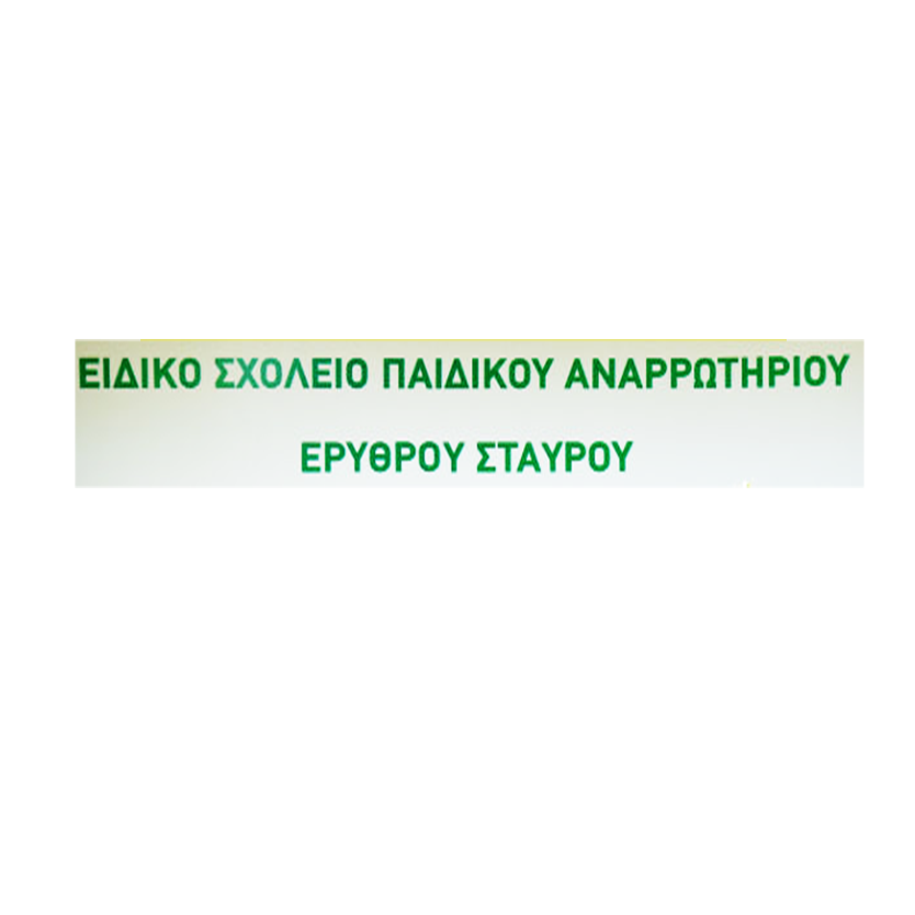
Below you can find some presentations from the E3 event in Cyprus. Liepaja Society of the Blind Eidiko Sxoleio Paidikou Anarotiriou Erithrou Stavrou St Barnabas School for the Blind
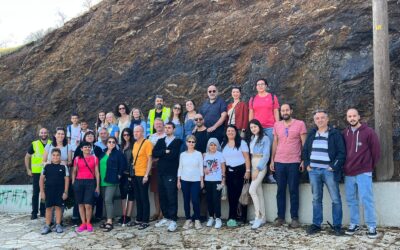
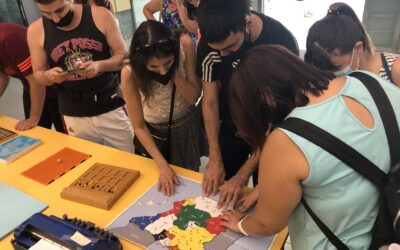
C3 and E3 in Cyprus
The C3 and E3 events took place with success in Cyprus. They included lectures, management meetings and visit to Troodos geopark.
LTT event in Liepaja, Latvia
A successful LTT event took place in Liepaja, Latvia with important app demonstration, geopark visits and management meetings.
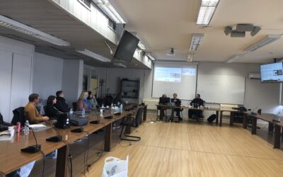
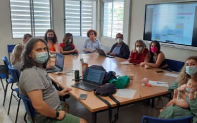
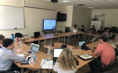
G4ViD Middle Evaluation Meeting in Patras
The G4ViD Middle Evaluation Meeting took place with success in Patras, evaluating the progress of the first half and scheduling the second half.
Visit in Western Greece Blind Association
One more app demonstration took place with aisit in Western Greece Blind Association.
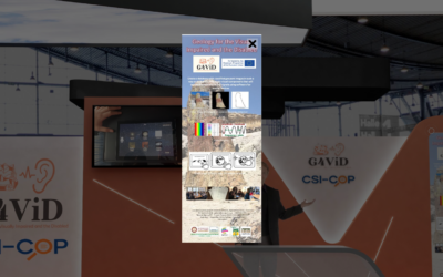
G4ViD in Patras IQ
G4ViD participated in the innovation expo Patras IQ organized by the University of Patras in hybrid digital/physical format.
C1 meeting in Sevilla, Spain
The C1 management meeting in Spain was a success, with important discussions about the direction of the project.
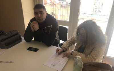
Consortium visits ONCE and demonstrates app
The consortium visited the Spanish Blind Association, ONCE, and demonstrated a beta version of our app.
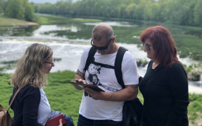
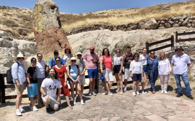
Consortium visits Sierra Norte de Sevilla UNESCO Global Geopark
Consortium visits Sierra Norte de Sevilla UNESCO Global Geopark, a geopark that will be included in the app, as part of the mobility in Spain.
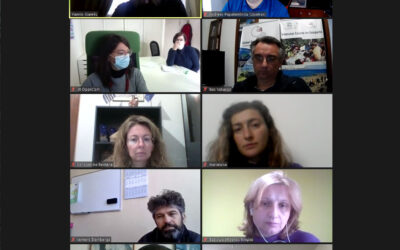
October teleconference
The 6th consortium teleconference took place on October 1st 2021.
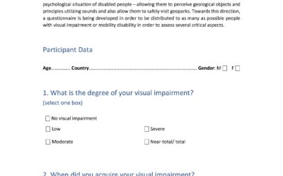
G4ViD questionnaires created
The G4ViD questionnaire was created and translated by partners in order to capture the preference of BVI users and specify application parameters accordingly.
Preparatory meeting in Lesvos
The first in-vivo meeting of the project was the preparatory meeting in Lesvos that took place at the University of the Aegean.
Consortium visits Lesvos UNESCO global geopark
Consortium visits Lesvos UNESCO global geopark
5th consortium teleconference
The 5th consortium teleconference took place on June 21st 2021.
4th consortium teleconference
The 4th consortium teleconference took place on May 17th 2021.
3rd project teleconference
The 3rd project teleconference took place on April 12th 2021.
2nd project teleconference
The 2nd project teleconference took place on 15th March 2021.
Project kickoff via teleconference!
Due to COVID-19 restrictions, the project kickoff took place via teleconference!
Contact
National Agency IKY
Project: 2020-1-EL01-KA201-079157
Start date: 1 September 2020
End date: 31 August 2023
Coordinator of the project:
+302610996440
email: g4vid@g4vid.eu